Tuesday, August 4, 2015

Over the Cascades

Monday, August 3   Day 2   Sedro Wooley to Winthrop, WA   129 miles, 8000' of climbing

I'm entering the park from the western side, and we biked over the summit (Washington Pass) and ended way down beyond the mountains to the east. It was a another great day for a bike ride, with tons of beautiful scenery. A "highlight" of the day was that I had my first flat tire in over two years. Fixed it in a jiffy and continued on.
The day began in our motel parking lot, as the staff was preparing our breakfast. They serve far more than you'd expect in a restaurant, including lots of fresh fruits and toppings for the oatmeal. This was at 6:20 am! Departure by 7:00.
The ride was flat for the first 50 miles or so. Around every bend I kept thinking it would start to go upward, but it wasn't until our 2nd rest stop at mile 54 that we began our long climb.
During the first 20 miles we came to town called Concrete. It's funny that they put this welcome sign on a huge slab of concrete.
Is this the chapel of the Seven Dwarfs?
We passed so many lakes and rode along so many rivers, I will just post photos without captions most of the time. You can get a flavor for what we got to see as we pedaled along.
I'm on a TALL bridge over this river basin, which enters the lake. If you looked on the other side of the bridge, there was a waterfall (without much water though).
 We rode across that bridge, and then up a long hill.

 It was not long after this I had my flat tire. My CO2 cartridge inflated the new tube in an instant.
 Diablo Lake.
 Looking south from the Diablo Lake viewpoint.

The name of our bike tour is Pacific Crest, named after the actual trail. At this spot, we crossed the actual trail.
Approaching the Washington Pass summit. The steepness of the climb was not as difficult as many on the previous tours I did this summer, but the climb was long - about 30 miles.
And there's the sign for Washington Pass, at 5477 feet. My odometer read 98 miles. After this, it was 30 miles of mostly downhill to Winthrop. The initial 10 miles were through a spectacular valley, as you will see in the following pictures:

 That's the valley we descended.
 Spectacular sawtooth peaks.
After this photo, I took no more until we reached Winthrop. Actually, I had to ride a mile back into town two get these photos because when I rode through the first time, I was in a hurry to meet my massage appointment at 5 pm.
 The town had lots of character!
Jerry and Steve came with me back into town so we could find a good restaurant. I had a new saddle sore, but we had to ride the bikes because the only thing near the motel, south of town, was a pizza place.
 We were going to eat here, but chose another down the boardwalk.
Check out the REAL boardwalk, and it was on both sides of the street. At our restaurant, I had the rib special, and I'm glad I ordered the half rack and not the full rack, because ribs covered the entire plate.
This old coach was right next to our motel. No sign, just sitting there. I tried to get on the Internet, but the signal was too weak. Thus, I'm writing this posting the next night in Leavenworth.

Sunday, August 2, 2015

Pedaling up through Whidbey Island

Sunday, August 2   Day 1   Everett to Sedro Woolley, WA   98 miles, 4800' of climbing

A highlight for me today was crossing Deception Pass. I don't think I even knew about this spectacular spot on Whidbey Isalnd, but WOW.

The day started early with a 5:30 breakfast and 6:15 departure so that we would all be on the 7 am ferry to the island.
Here we are waiting for the ferry. We all made it on time, despite one rider having a flat tire during those first 7 miles.
Bikes got to go first onto the ferry, and later we got to depart first. What a shock.
All those bikes look pretty funny there, and that's only about a quarter of them. We were strewn all over the front of the ferry like that. It was only a 2.5-mile trip to the south end of the island. The weather was nice and brisk, which was quite a change from the triple-digit weather I'd been riding in for about three weeks since the end of the Blue Ridge Parkway tour.

During the first half of the day, the route was in rolling, woodsy areas that were just...NICE. Trees, flowers, not much traffic, but also no views of the ocean.
There's our first rest stop of the day, at 24 miles. I'm still getting used to having so many riders and so many bikes on this tour.
Here's my roommate, Bob Lewis, of Mesa, AZ (suburb of Phoenix). We're matching up great so far. He hasn't broken his bones as seriously as I have, but he sure has stories about breaking bikes and bike parts.
And this is Bill, with whom I rode across the country in 2007. (He lives near Tuscon, AZ.) He has been on many of these PAC Tours, and so has Bob. Actually, about 20 of the 31 riders have, so with the 12 staff who know them, it's one big happy family out there.
After about 30 miles, we got a few glimpses of the ocean, but it wasn't until about 45 miles that we started riding along the coastline more frequently. It was a beautiful day, and remained brisk for the entire morning. It never got hot until late in the day.
A change of scenery and landscape farther up the island.
Saw quite a few deer today, including these on the front lawn of this rental cottage. At the identical cottage next to this one, the visitors were all out on those porch rocking chairs.
Quaint little village of Courtville, where we had a brief rest stop at Mile 45. There were several Victorian B&Bs like the Anchorage Inn that's in this photo. The road is blocked ahead because they were having an annual street fair. We had to ride around it because our route called for riding right through it.
 This red-bark tree and picturesque bay came right after we departed Courtville. I learned that the tree is called a Bear Berry, or Madrona. Anyone have a guess as to what all the floating platforms are out there? Oysters?
 After riding through more wooded areas for a bit, we descended into this attractive bay.
I loved this sign on the road through the bay, but darn, I didn't see any.
And suddenly we came to Deception Pass! I knew from our map that we were going to go over a Deception Pass, but after riding over the Continental Divide 10 times in June, a "pass" to me meant the summit of a mountain climb. This passage was named by Captain George Vancouver in 1792 because he thought it led to more exciting places than it actually did.
I too was deceived, because I thought the first bridge we crossed over -- from where I took the photo above this one and the one at the top of this posting -- was the only bridge. It turned out, once I got back on my bike to proceed north, I went over this second bridge. That first spot I stopped for photos was a big rock right in the middle of the passage. You can see the first bridge in the background of this photo. It was all an amazing spot to see. The bridges are WAY up high over the water.

A few miles after Deception Pass, at our Mile 74, we had our lunch stop. Lots of good food and service by the helpful staff. We use plastic plates and utensils, and the staff wash them for the next food stop. They were always busy stocking the food and keeping us riders happy.
Several miles after the lunch stop, we crossed this inlet from the more open ocean to the north. There were many trawlers cruising south. I turned around and to the northeast was the top of Mt Baker:
We got to see this peak many times today, but the only time I took a photo of it was so I could get all these attractive electrical lines in it. haha (This was on SR 20 and it was busy, so I could not just walk across the bridge to avoid those wires in my shot.)

Soon I crossed over I-5 and was headed to our destination town, about 10 more miles. When I reached our motel, the riders who had already arrived (most of them) were busy cleaning, lubing, and adjusting their bikes while waiting for 3 pm when the rooms would be ready. Everyone here seems to know all about maintaining their expensive bikes! 
On this tour, one of the staff, Barb, from Lincoln, NB, is a massage therapist. I have already signed up for five during this tour, and my first was today. Fabulous. My second is tomorrow, after our 126-mile day crossing over the Cascades to the eastern side. While our route sheet today took four 8.5x11 sheets of paper with all the turns we had, tomorrow's is one sentence: "Depart eastward on SR 20 and 126 miles later, turn into our motel."
Here's the profile for tomorrow's ride. Up for 98 miles to Washington Pass (the kind of "pass" I'm accustomed to), and down for 28.

On this tour we are on our own for dinners. There weren't too many choices withing walking distance, so Bob and I went to a Subway and found most others there too. No 6"ers for us...after 98 miles, we all ordered the foot-longs!
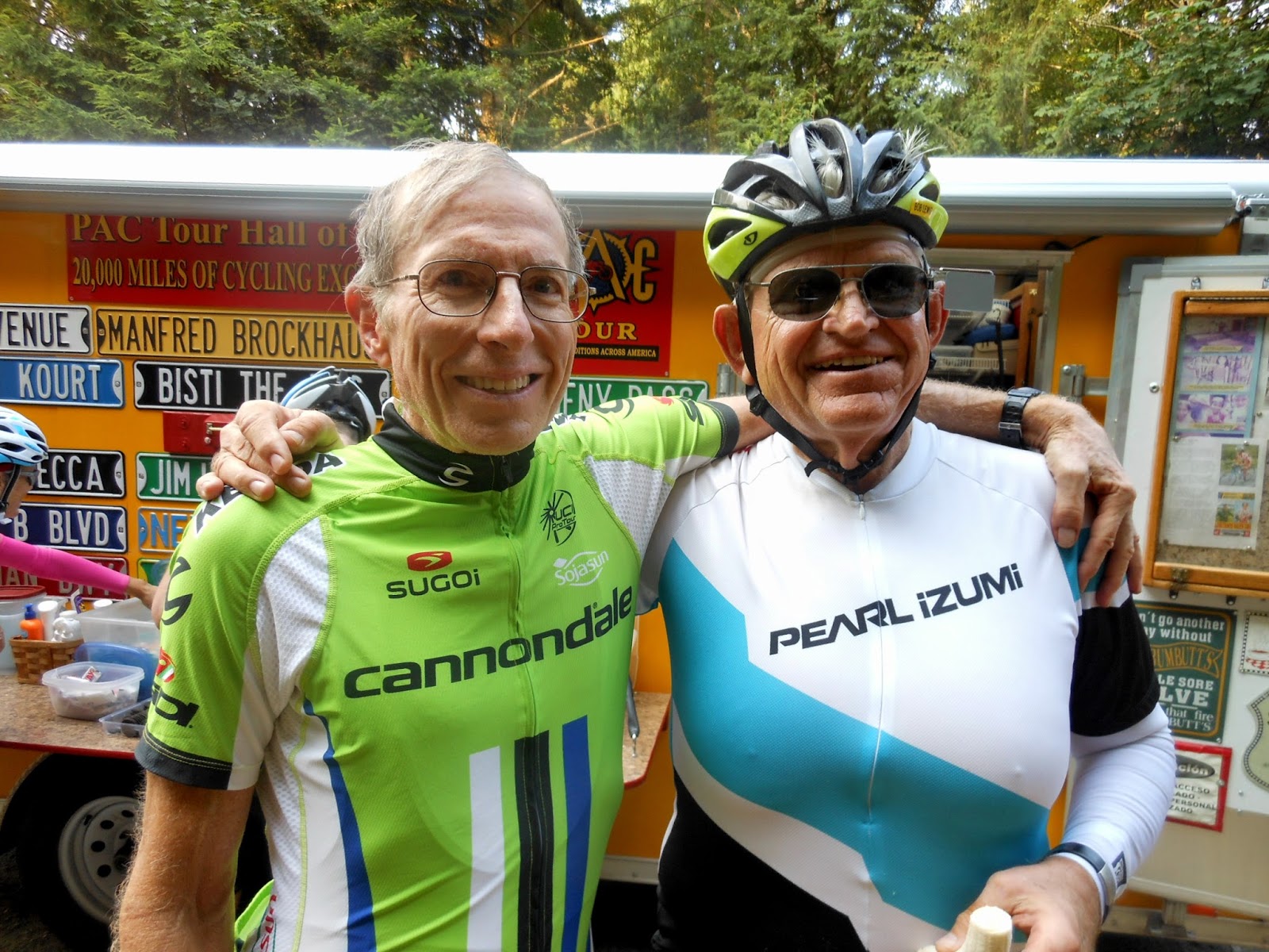
P.S. I love to see all the various jerseys that cyclists wear. Gretta's here is a classic!


Saturday, August 1, 2015

Pacific Crest tour to begin

Saturday, August 1  Day 0     Everett, WA

Tomorrow morning we depart on the 12-day, 1215-mile Pacific Crest tour. I am in Clarkston, WA at the moment, but will depart in an hour to drive across Washington to Everett, which is north of Seattle. This tour is different from the other two this summer in that there will be 31 riders and another 12 staff. It will be huge!

That photo, by the way, is from my first Continental Divide tour, when I was climbing a long hill in New Mexico on my way to Los Alamos.

I am curious to see who my roommate will be for this tour. On the previous tours, I knew my roommates (when I had one). It's always fun to get to know a new friend, as long as he doesn't snore. haha  I do know that one of the riders is Bill Phillippi, who was in the group that rode across the country with me in 2007. I'm looking forward to riding with Bill again.

Here's a brief summary of this bike tour:
1) Take the ferry to Whidbey Island and ride north to the end and back to the mainland.
2) Cross the Cascades to the east side, and then ride south to the quaint "Bavarian" town of Leavenworth on Day 3. Janet and I spent a couple days there in 2011 while we were taking care of Tyson during his first five months, and we loved it.
3) Continue southward on the eastern side of the Cascades, but then head back into them and south through the mountains to the Columbia River.
4) Climb to the Timberline Lodge on Mt Hood, then south through the mountains to Bend, OR.
5) Ride back into the Cascades, around Mt Bachelor, and south past Crater Lake to end in Ashland, OR

Since the Blue Ridge Parkway tour ended three weeks ago, I have not ridden very many miles. I bruised a rib 9 days ago and for the first few painful days, I feared I might not be able to ride this tour. Fortunately, it has gotten better, but I have ridden only about 100 miles since that time.

I departed in my car last Sunday, and after a few hundred miles I realized that I FORGOT MY FRONT WHEEL. What??? How could I forget my wheel? I immediately phoned Janet's mom about calling a family friend, Mike, with whom I've ridden several times in Clarkston, to see if he might have a spare wheel I could borrow. Lucky for me, he did have one for me. Interestingly, it comes off his Scattante bike, which is the exact bike and model year of my Scattante I was riding when its fork snapped apart and I broke my neck in 2007. When I first went on a ride with Mike back in 2011, and he showed up riding that bike, I sorta freaked out. There was that "evil" Weyless fork that "betrayed" me, rolling along next to me.

I have enjoyed being here with Janet, who flew in with Tyson last Tuesday night, a few hours after I arrived from my three-day drive across the country. I will return here to Janet's parents' house on August 15 to pack the car back up with her things and Tyson's new toys, and arrive back in Ohio on about Aug 18.

As usual, I will try to post on this blog nightly, but it always depends on how strong the Internet connection is. Also, on this tour with 31 riders, I will have to see how the daily schedules go before I will know how conducive it will be to find time to write a blog each night.
Time for me get going on my 6-hour drive to Everett. This photo is from the Blue Ridge Parkway a few weeks ago.  I can't wait for tomorrow's tour, which was the first of this summer's tours that I signed up for (and thought would be my only one, until the other two came along).

Added note: I'm here in Everett and it's been wild meeting and seeing SO many cyclists! Most of them have ridden with PAC Tours before, but I'm one of the newbies. I've met only a portion of the 42 others, but so far, so good. My roommate is Bob Lewis from Phoenix, who is 69 and has an illustrious cycling history. It's early to bed because tomorrow it's early to rise - breakfast at 5:30, load the trailers at 6:00, depart before 6:15, and make sure we are all on the 7:00 ferry to Whidbey Island. They promised that after tomorrow, we will be able to rise at later times if we wish. Oh, this tour has a massage therapist! I've already signed up for six of them over the next 12 days.

Sunday, July 12, 2015

Spectacular final day

Saturday  July 11   Day 7   Asheville to Cherokee, NC   94 miles, 11,680' of climbing

634 total miles with 66,612 feet of elevation gain (avg of 91 mi and 9516 ft per day)


We completed the ride successfully yesterday! Lots of climbing, lots of incredible scenery, and a great final day of bike riding. This photo was at the highest point along the BRP, where we ate our lunch with only 38 miles to go. Only Mark was missing since he hadn't arrived yet. Chuck is in street clothes because, unfortunately, his Achilles tendon swelled up and was very painful. He was disappointed not to ride, but at least he'd ridden it on two previous occasions.
 Just after riding past Asheville in the morning, we crossed the French Broad River, which flows northward. At that point, we had a long climb to Mt Pisgah. Probably due to its being a Saturday and close to a big town, vehicle, motorcycle, and bicycle traffic on the BRP was significantly busier than usual. The day before was busier than usual too, and many bicycles climbed Mt Mitchell that day.
During this tour, we had 27 tunnels, which required both front and tail lights. On this final day were about 19 of them, and here are Alvin and Jill about to enter one of them (it's a blurry shot, but still my best out of about 10 tries over the previous several days).
We're about to finish riding through it. Out of the 27 tunnels, only two of them got completely dark inside due to their lengths and curves.
Another of thousands of spectacular views as we pedaled along this National Parkway. This photo, however, doesn't begin to capture the distant views of green mountains and valleys.
 Devil's Courthouse refers to that rock outcropping up there. This particular turnout was jam-packed with cars and tourists, many of whom were taking hikes. Certain other turnouts were too, presumably because they were trailheads for these weekenders.
One more viewpoint I decided to photograph. As I say, these views were never-ending during our seven days of riding, as long as there was no fog. My favorites were the many times we were right at the mountain crest and could look to both the eastern and western valleys simultaneously. 
This photo and the one below were taken at a visitor center called Waterrock Overlook. This was another crest point, so this photo is to the north and the one below is to the south. The top photo shows our BRP and where we had been riding a few minutes earlier, whereas the photo below shows the ominous weather we were heading into (we did get rain).
This location brought back clear memories from seven years ago because we also had a rest stop here. And, with only 18 miles left to go, most of which was downhill, I remember the emotions were beginning to bubble up in me because I knew I was going to complete my goal of finishing the BRP after my broken-neck accident 9.5 months earlier.
This is Mile Post 468, to begin the final mile. As described in Head Over Wheels, this was where my emotions spilled over and I was sobbing in gratitude almost the entire final mile.
I didn't cry this time, but this was where I balled last time as I saw the completion of the parkway. This is Bryan riding past me.
There is the final Mile Post in front of the river, the official end of the BRP (or the beginning, if going in the other direction). The Great Smoky Mountains are just beyond.
And then along came Alvin and Jill, with their tunnel headlights still on. In the background, you can see the familiar sign for entering the Blue Ridge Parkway. Quite an accomplishment for us!
My final photo of this tour shows kids playing in the Oconoluftee River.

There were five of us who rode into the finish there (I did not get Jeff's picture, but I did cheer for him!), and then we needed to pedal a few more miles to our motel in Cherokee. With a long day and so much climbing, it was after 6 pm by the time we got there. We needed to get cleaned up and to our dinner, and our chance to reflect on this super tour that Chuck and Suzette planned and executed so well for us all. Everyone had a wonderful time, with new friends and memories.

Now I have three weeks before Tour #3 begins in Washington. However, I will depart by car on July 25th, so that gives me only two weeks at home. For the first two tours, my mileage comes to 2081, and my elevation gain is 128,212. Tour #3 is supposed to be the most difficult. I'm glad I've gotten into good shape!

Friday, July 10, 2015

Mt Mitchell time trial

Friday July 10   Day 6   Little Switzerland to Asheville, NC   62 miles, 6860' of climbing

As Alvin said it, this was the "podium" shot, meaning the first three people up to Mt Mitchell. That's the summit right behind us, a five-minute walk we all did later after eating our lunch from the van in the parking lot. This posting is titled "Mt Mitchell time trial," but only Alvin and I actually raced up it for time. He gave me a one-minute head start, and I was determined to not let him catch me. I gave it everything I had; I haven't panted so hard in a long time like I did up that five-mile grade from the BRP. Alvin said he had to give it his hardest too, and he did catch me with about 1/4 mile to go. 
Alvin set his best time ever, and I was with him at the finish, so I was able to get my time (his time was recorded by GPS). I did it in 25:54. Chuck looked it up using his "Strava" program and said my time was the 106th best out of about 2200 recorded times. I was so spent after the "race" that it took a LONG time to recover. Alvin took this photo of me while we both were still panting.

The day began beautifully on the side of the mountain at our Alpine Inn.
Check out the view from the porch where we ate our breakfast! We all marveled at how slanted the whole lobby/restaurant building was -- they said it had settled over the years ever since it was built in 1929, and it now slants noticeably back toward the roadway. I don't think any of us could have handled it if the slant was the other way -- down the hill! We finally departed by about 9 am, and our first mile was up the steep grade back to the BRP.
As you can see, it was another beautiful day, with the by-now usual vistas of the valleys and mountains off to both the east and west. In this case, I got to see Mt Mitchell for the first time, 1860 feet higher than where I was standing.
A selfie at the base of the climb. From the previous photo, we had to descend a long ways, then climb again to get here.The vans were parked to the right, and we all had a chance to eat or drink prior to the ascent where lunch would be in full swing.
After lunch, we all walked the short distance to the very summit. That's a big platform behind me for people to get views in all directions.
From that platform, I took this picture showing a portion of the road we had ascended. Once we descended back to the BRP, most of the remaining 30 miles to Asheville was also downhill.

There is a side story I want to tell: WEEVILS! Thousands of tiny weevils were blowing in the wind atop Mt Mitchell that stuck to everything - our clothes, our food, our bikes, everything! They looked like little ticks, but we heard they were harmless. Every time we'd brush them off, a hundred more landed right away. It was a major memory of everyone up there on the mountaintop, including hundreds of tourists. At all times, people were brushing off weevils. 
There was a visitor center at Craggy Rock, just after riding through one of six tunnels today. I loved this wooden poster you could buy, but this photo will suffice.
 They also had these rocking chairs to view the scenery. Gosh, Alvin doesn't have a bald spot!
From Craggy Rock, it was ALL downhlll for the final 17 miles. THAT was fun! This is my final photo for the day, during the long descent. Once off the parkway, it was just one mile to our motel. I had rolled up my vest and stuffed it into my jersey pocket back after we descended Mt Mitchell. At the motel I unfurled it and picked out the dozens of weevils inside.

Mexican restaurant for dinner, then yesterday's and today's blogs, and now bedtime.

Tomorrow is our final day, and it's a tough one - 92 miles with 11,680 feet of elevation gain. I'm looking forward to it, especially the final few miles, when I'm sure I will be remembering how I felt 7 yrs ago.