Sunday, June 21 Day 15 Walden, CO to Rawlins, WY 110 miles
I had to laugh at this sign on Interstate 80. Strong winds possible? Here I was after about 7 hours since we departed Walden, and we had experienced extremely strong winds all day long -- and then this sign says they're "possible"? hahahaha It was especially funny because at the time I saw this sign, I was riding INTO about 25-mph headwinds. Luckily, the winds were helpful most of the day -- for about 80 of the miles.
It was a bright, sunny day to begin (with strong tailwinds), and I got this great shot of Bob and Susan Long.
The road ahead was as straight as those late yesterday, but at least we had some hills to break up the monotony.
At the 22-mile rest stop, we crossed into Wyoming. Since my tour ends Wednesday, this is my final state, whereas the other original five have Montana, British Columbia, and Alberta yet to reach. Oh, and check out the landscape ahead. It typifies most of what we saw today, although we did ride through some areas with rivers and trees and more to see.
This decrepit cabin struck me as representing this part of the old west. You wonder what its history was?
Something besides cows! I associated these horses with the movie The Horse Whisperer since, in the end, Robert Redford releases his horse to a wild herd in ...Wyoming.
Lest anyone forget, after many more miles up the road, it looked like... THIS! The good part was, we still had a strong tailwind. My average speed was about 21.5 mph at this point, which tells you how strong that wind was.
Such a delightful thing to finally see - water! All those days in Colorado with all that water, and now I rejoice to see a little. This is the Encampment River in Riverside, where we had our 2nd rest stop at mile 49. Just prior to this, for about 10 miles, the winds became headwinds and we slowed way down. Fortunately, in Riverside, our road turned right and it made the winds tailwinds again.
Here's a photo of the Riverside rest stop, and you can see we had a little greenery.
At mile 68 we had our lunch stop, and it was really windy. The food items kept blowing away. Dennis made me a hearty ham and cheese sandwich, and I got all refueled. No photos from the lunch.
When I resumed my ride, the winds were favorable and pushing me along at a fast clip. This marker notes the Overland Trail and the Platte River crossing, 1861 to 1868. I rode over the wide and fast-moving Platte River as I was leaving the lunch stop in Saratoga, but they were doing road work and routing us by in a single lane, so I couldn't stop to take a picture. It looked very nice, that river.
When I got here, the fun of riding with a strong tailwind was over! As you can see, I reached Interstate 80, where I had to turn west, directly into the wind. Rawlins was still 22 miles away. At that point, I had an average speed of 20.5 mph, which again indicates how strong the day's tailwinds had been. I had been excited about getting to ride on The Lincoln Highway for a short distance at this spot. However, at the rest stop just under the freeway there, Paul said he had scouted ahead and the Lincoln Highway was left in disrepair, and we could not ride on it. So, instead of that, we would ride on Interstate 80 from here.
I should mention that my front derailleur was still no better, so I still was without the use of many of my middle gears. However, on this day, with the tail winds, I was comfortable using the higher gears available to me. And, with the strong headwinds at the end, my low gears suited me. Thus, I did not really need the middle gears today that I could not use.
Other than having to ride into the strong headwind, riding on an interstate is not bad at all. The shoulder was wide and smooth, and the big semi trucks would always provide a welcomed push of air as they zoomed past. Some big rigs would move over to the left lane to give me extra room, but I would think "No no, stay in the right lane and give me your push!"
After 15 miles on the interstate, I got off at the town of Sinclair, so named for the huge Sinclair Oil refinery there. The town has only 453 residents. This historical marker explains how it originally was the Producers and Refiners Oil Company (PARCO), and they built this impressive Parco Inn. And the city was named Parco. But in 1934, they sold to Sinclair, who changed the city's name to match the new name of the oil company.
This is the final lonely stretch of road into Rawlins. I was no longer helped by the passing big rigs, so this was the most difficult stretch to ride again the wind that by now was gusting up to 30 mph. But it lasted only about six miles. I was glad to finally be done with the ride! I had been out for nearly 8 hours, and riding for 6 hours.
The reward! Corey and Bob Long brought these to Ken's and my room (I don't recall if I ever said in my blog that I'm rooming with Ken Whiteside), and boy, were they refreshing! I love the name too, since we will soon be riding in the Grand Tetons.
Our dinner was at a Thai restaurant, and what a welcome change that was! We split up the group, since the five Maryland riders wanted to eat where there was a TV so they could watch the final rounds of the U.S. Open golf tournament. They are all huge golfing fans.
Tomorrow is a 125-mile day to Lander. We are optimistic that the
forecast calls for much cooler temperatures and, more importantly, far
lighter winds (4 to 10 mph). And, the winds are supposed
to be favorable for our northwest direction ride. We hope that forecast will hold up!
Map and profile: http://ridewithgps.com/routes/7849963
Sunday, June 21, 2015
Saturday, June 20, 2015
Northern Colorado is different!
Saturday, June 20 Day 14 Winter Park to Walden, CO 75 miles
Our scenery changed today! As we rode north from Winter Park, the horizon opened up. I didn't see any of the familiar snow-capped peaks -- until we had ridden about 13 miles. We did climb to 9683-ft Willow Creek Pass for another crossing of the Continental Divide (our 7th), but then we descended to the road in the photos above...with strong winds. I took the top photo first, and when I reached the farthest point you can see in it, I took the second one. Yes, pretty much straight and desolate.
Where we are tonight, Walden, is very much a small cowboy town in the middle of a wide prairie.
The day actually began with a "ceremonial" moment for me -- throwing away my PowerBar water bottle that I've used for about 10 years. Paul gave everyone new Black Bear water bottles last night, so I needed to throw away one of my existing bottles (no room to carry an empty one). The PowerBar bottle was in bad shape, so it was the one that had to go. But then I got to thinking all that that bottle had been through with me, most importantly when I had my near-death accident in 2007. When I told Janet about this in a morning phone call, I actually got emotional. Anything that gets me thinking about my miracle survival and chance to live again gets me emotional.
Here I am at our 7th crossing of the Continental Divide, at our 42-mile mark. We crossed from the Pacific side to the Atlantic side. On our way up the grade, many miles back on the Pacific side, we crossed the Colorado River just 10 miles from its headwaters. Exciting to think the water we saw would someday be flowing through the turbines at Hoover Dam.
During our rest stop at this pass, I fiddled with my rear derailleur because I kept hearing noise in many of my gears. I had already stopped three times to look for what was causing the noise. Finally I found the reason: My derailleur had been adjusted too far to the right such that the chain was rubbing in many of the middle gears. I tried adjusting back the derailleur, but if I did, then the original problem would return, which was that it would not shift from the small to large chain ring. So as to not rub the chain, I could not use about 7 or 8 of my gears, and they were right in the middle of my gearing range that any bike rider would use most often. This meant that I had to use a much higher gear (or too low a gear, but I tended to use the too-high gear so that I wouldn't be going too slowly) instead of one I would have preferred to have been riding in for much of the day's ride.
Also on the way north prior to this pass, we stopped to say hello to Susan Long's sister and her family at their ranch right there on our route.
The trees thinned out during our descent from the pass, and the roads got straighter. It was an omen of how flat and tree-less it would soon become.
At 62 miles we had our lunch stop, right in the middle of nowhere on the wide-open prairie. Neil and Sue look happy to be resting up for the final 12 miles to Walden.
"The moose-viewing capital of Colorado"!! I've seen dozens of moose here, but so far no live ones. Maybe tomorrow morning.
Here's Main Street. On the far left is our hotel, but also look out beyond. Doesn't it look like the two photos at the top of the posting? That's what tomorrow's ride should continue to look like.
Many of us got to the hotel before the van, so we just hung out in front. If you opened the front door, here's what you saw:
A stairway to our rooms. Straight ahead (to the left, which is not in the photo) was the door to the bar and restaurant. The metal plaque on the wall on the left of the photo states: "It is illegal to smoke marijuana on the premises."
Several of us went straight to the bar for some brews. Dinner in the same room included all 17 of us, and for me, it was their "Saturday Night Feast" - a 12-oz prime rib with all the fixins.
Tomorrow we will leave Colorado and enter Wyoming at mile 22, near the beginning of our 108-mile ride. I hope the forecast for wind direction holds up, because they are supposed to reach 25 to 30 mph! They are supposed to be from the side, but with a little bit of tailwind. By the way, we had strong cross winds in the prairie, and when a big rig would pass going in the opposite direction, it caused a HUGE burst of cross/headwind. We had to be super-ready and steady to avoid getting blown over - literally.
Segment 2 begins
Friday, June 19 Day 13 Rest day in Winter Park, CO Zero miles!
As you can see, it was a bright sunny day for our day of rest. I enjoyed the down time, including a massage! Laundry got done. Rotated my tires. Worked on the previous blog posting.
We had eight people join us to begin Segment 2. This segment runs from Winter Park to Missoula, MT. I, however, will be leaving the tour after five more days, when we arrive in Jackson Lake, WY.
Here are the new riders:
1) Susan Long, Bob's wife. I rode with her on last year's Natchez Trace ride.
2) Neil Cohen, from Potomac, MD
3) Marc Bassin, from MD
4) Robert Massey, from Bethesda, MD
5) Michael Gildenhorn, from MD
6) Albert Small, from MD
[these five from MD are all good buddies and have done numerous rides together]
7) Dennis, who will assist Rod with our needs for food and other matters.
8) Fred, who will drive the other van with a trailer. We now have two support vans.
Today's ride is 74 miles with 3200 feet of climbing.
This is the laundromat yesterday. At least the view was nice, because that river ran by right out the windows.
Friday, June 19, 2015
Glorious climbs and 100 miles
Thursday, June 18 Day 12 Leadville to Winter Park, CO 101 miles
Almost 12,000 feet here at Loveland Pass! This was our fifth crossing of the Continental Divide, and our sixth would come later in the day. Earlier in the day, we rode over Fremont Pass at 11,318 ft, giving us three big climbs for the day over passes exceeding 11,000 ft. It was a long day - almost 7 hours of riding for me, and 10 hours out there total (so, about 3 hours of taking rest stops and lunch, and posing for photos like the one above).
Here's a shot from early in the day, beautiful as usual. The weather yesterday (I'm writing this the following morning) was excellent - sunny, not too cold or hot, although the final climb late in the day was getting pretty warm. That's Craig closest to the camera, and Bob on ahead.
I like this picture because it shows the road we have just been climbing as we departed Leadville. Not too steep just yet; later in this blog posting, I have similar photos when the climbs were much steeper.
During the first 15 miles or so, we came to this incredible scene (Clinton Gulch Reservoir). Love that reflection in the lake! You can tell from my wearing a wind breaker that the morning was brisk, but that jacket came off and I needed it only for the descents from the stratospheric passes we rode over. The snowy mountains in all my pictures confirm how beautiful our scenery has been here in Colorado.
This is Tenmile Creek at our first rest stop (mile 23), looking back at the valley we just rode through. We entered a bike trail right at this spot and got to ride next to this river for a long ways. This location is where we met up with Interstate 70, which we basically rode near AND ON for the next 47 miles.
This is our bike path and Tenmile Creek. Interstate 70 was just a hundred yards or so to the left as we paralleled it. I loved this section next to the rushing river. After a time, the path turned eastward, away from the interstate, and wound its way through a residential area (Frisco) and over a steep climb and then down to where we had another break before starting the long Loveland Pass climb. All along this part of the ride we had views of big lakes and reservoirs, but apparently I did not stop to take any photos.
Then at mile 38 we began our ascent of Loveland, and the photo above, from about one-fourth of the way up, shows how far we have come and how steep it was. We had a rest stop about half way up, at the Arapahoe Ski Area. As the road rose from there, I took this photo back toward the ski area.
Up, up and up about nine miles to the summit, and here comes our van:
A gentleman took my photo at the summit, the one at the top of this posting, before I moved on. Prior to this trip, I had been concerned about how my body would handle the high altitudes. I can report that I and the others have not noticed anything significant. The one thing I have observed is when I drink from my water bottle - in the few seconds it takes to drink and swallow, I get amazing out of breath. I pant for many seconds as if I have just been sprinting.
I then descended, but stopped partway down to take this photo of the roadway farther down, Interstate 70, and the snow-covered mountains behind. My son Brian and I would have driven through here in 2001 on our way from home in Simi Valley, CA to Columbus where he was beginning his doctoral program in physics at Ohio State University.
Once I reached the bottom, our route took us right up onto the interstate. The mystery of the day was why the westbound lanes were blocked up and barely moving for the entire three hours we continued along it. This morning, Neil said he researched it and it was road construction. Riding on the shoulder of interstates has usually been okay, but the first mile or so here it was terrible. Piles of sand, holes, and rough surface forced me to ride very slowly. Then it cleared up for the remaining few miles before we departed and used a frontage road.
The frontage road was nice because there was no traffic and I was next to this rushing river for a long ways. Off in the distance you can see the trucks on the interstate.
I came to this railway station for a tourist train that runs between here and Georgetown, farther east several miles.
As I rode on, I was able to see the train across the valley, tooting its horn as it went.
I also got this photo of the train bridge over Clear Creek. From where was I taking these photos?
From this bike path immediately adjacent to Interstate 70. You can see the line-up of traffic on the other side, which I mentioned previously.
In a few more miles, I reached Georgetown, a Victorian village once known as the Silver Queen of the Rockies. The sign said that visitors in its day included Annie Oakley, Buffalo Bill Cody, and brothel-keeper Mattie Silks.
A little farther along was our lunch break, at 67 miles, and this scenic lake. We did have to wait awhile since the van arrived late, but it gave us extra rest to prepare for our final climb. When we finally enjoyed our homemade burrito meal, it was 3:15 and we still had 31 miles to go.
We then began our ascent of Berthaud Pass on Hwy 40, The National Road. It was exciting to know I was on U.S. Hwy 40 since I first rode on and learned about it in Indiana on my ride across the country in 07. It also crosses Ohio just north of Interstate 70, and I've ridden on it a few times there.
Once I'd ridden up some distance, I saw this view back of the valley I'd come through. It always give me a sense of accomplishment when I see scenes like this of how far I've ridden.
Corey took this photo of me at the summit, our 6th crossing of the Continental Divide.
Corey also took this because it shows a beautiful view toward the north and the roadway I'd soon be descending on into Winter Park, 12 miles away.
Once in Winter Park, I missed the motel and had to circle back. This gave me a couple extra miles which put me over 100 miles for the day. I got to visit with Susan Long, Bob's wife, who will now join us and six others to continue with Segment 2. In about 30 minutes, the others arrived and we all got to congratulate each other on completing not only a long day, but our 12 days of Segment 1.
Paul hosted a champagne toast at dinner to celebrate these same accomplishments. It was a fine evening! Today is a welcomed day of rest. My massage was wonderful. Laundry. Fine-tuning the bike. Writing this blog (which I lost half of, and had to re-write).
Here is our route map and profile for tomorrow (Saturday): http://ridewithgps.com/routes/7849328
It will be 74 miles and about 3200 ft of climbing, which after all our climbing recently, will probably feel flat (haha).
Almost 12,000 feet here at Loveland Pass! This was our fifth crossing of the Continental Divide, and our sixth would come later in the day. Earlier in the day, we rode over Fremont Pass at 11,318 ft, giving us three big climbs for the day over passes exceeding 11,000 ft. It was a long day - almost 7 hours of riding for me, and 10 hours out there total (so, about 3 hours of taking rest stops and lunch, and posing for photos like the one above).
Here's a shot from early in the day, beautiful as usual. The weather yesterday (I'm writing this the following morning) was excellent - sunny, not too cold or hot, although the final climb late in the day was getting pretty warm. That's Craig closest to the camera, and Bob on ahead.
I like this picture because it shows the road we have just been climbing as we departed Leadville. Not too steep just yet; later in this blog posting, I have similar photos when the climbs were much steeper.
During the first 15 miles or so, we came to this incredible scene (Clinton Gulch Reservoir). Love that reflection in the lake! You can tell from my wearing a wind breaker that the morning was brisk, but that jacket came off and I needed it only for the descents from the stratospheric passes we rode over. The snowy mountains in all my pictures confirm how beautiful our scenery has been here in Colorado.
This is Tenmile Creek at our first rest stop (mile 23), looking back at the valley we just rode through. We entered a bike trail right at this spot and got to ride next to this river for a long ways. This location is where we met up with Interstate 70, which we basically rode near AND ON for the next 47 miles.
This is our bike path and Tenmile Creek. Interstate 70 was just a hundred yards or so to the left as we paralleled it. I loved this section next to the rushing river. After a time, the path turned eastward, away from the interstate, and wound its way through a residential area (Frisco) and over a steep climb and then down to where we had another break before starting the long Loveland Pass climb. All along this part of the ride we had views of big lakes and reservoirs, but apparently I did not stop to take any photos.
Then at mile 38 we began our ascent of Loveland, and the photo above, from about one-fourth of the way up, shows how far we have come and how steep it was. We had a rest stop about half way up, at the Arapahoe Ski Area. As the road rose from there, I took this photo back toward the ski area.
Up, up and up about nine miles to the summit, and here comes our van:
A gentleman took my photo at the summit, the one at the top of this posting, before I moved on. Prior to this trip, I had been concerned about how my body would handle the high altitudes. I can report that I and the others have not noticed anything significant. The one thing I have observed is when I drink from my water bottle - in the few seconds it takes to drink and swallow, I get amazing out of breath. I pant for many seconds as if I have just been sprinting.
I then descended, but stopped partway down to take this photo of the roadway farther down, Interstate 70, and the snow-covered mountains behind. My son Brian and I would have driven through here in 2001 on our way from home in Simi Valley, CA to Columbus where he was beginning his doctoral program in physics at Ohio State University.
The frontage road was nice because there was no traffic and I was next to this rushing river for a long ways. Off in the distance you can see the trucks on the interstate.
I came to this railway station for a tourist train that runs between here and Georgetown, farther east several miles.
As I rode on, I was able to see the train across the valley, tooting its horn as it went.
I also got this photo of the train bridge over Clear Creek. From where was I taking these photos?
From this bike path immediately adjacent to Interstate 70. You can see the line-up of traffic on the other side, which I mentioned previously.
In a few more miles, I reached Georgetown, a Victorian village once known as the Silver Queen of the Rockies. The sign said that visitors in its day included Annie Oakley, Buffalo Bill Cody, and brothel-keeper Mattie Silks.
A little farther along was our lunch break, at 67 miles, and this scenic lake. We did have to wait awhile since the van arrived late, but it gave us extra rest to prepare for our final climb. When we finally enjoyed our homemade burrito meal, it was 3:15 and we still had 31 miles to go.
We then began our ascent of Berthaud Pass on Hwy 40, The National Road. It was exciting to know I was on U.S. Hwy 40 since I first rode on and learned about it in Indiana on my ride across the country in 07. It also crosses Ohio just north of Interstate 70, and I've ridden on it a few times there.
Once I'd ridden up some distance, I saw this view back of the valley I'd come through. It always give me a sense of accomplishment when I see scenes like this of how far I've ridden.
Corey took this photo of me at the summit, our 6th crossing of the Continental Divide.
Corey also took this because it shows a beautiful view toward the north and the roadway I'd soon be descending on into Winter Park, 12 miles away.
Once in Winter Park, I missed the motel and had to circle back. This gave me a couple extra miles which put me over 100 miles for the day. I got to visit with Susan Long, Bob's wife, who will now join us and six others to continue with Segment 2. In about 30 minutes, the others arrived and we all got to congratulate each other on completing not only a long day, but our 12 days of Segment 1.
Paul hosted a champagne toast at dinner to celebrate these same accomplishments. It was a fine evening! Today is a welcomed day of rest. My massage was wonderful. Laundry. Fine-tuning the bike. Writing this blog (which I lost half of, and had to re-write).
Here is our route map and profile for tomorrow (Saturday): http://ridewithgps.com/routes/7849328
It will be 74 miles and about 3200 ft of climbing, which after all our climbing recently, will probably feel flat (haha).
Wednesday, June 17, 2015
Sunny scenic day to Leadville
Wednesday, June 17 Day 11 Salida to Leadville, CO 63 miles
Fun to watch yourself on a sunny morning! The ride to Leadville was almost all gradual uphill - gaining 4000 feet during the 60-mile ride. As you'll see from the pictures below, it was scenic with the 14,000-foot peaks to the west, and the Arkansas River next to us all the way.
I'd do better just to post pictures, which will speak for themselves. I did stop in Buena Vista for the 25-mile rest, but other than that it was just riding and seeing what the photos will demonstrate. One note: Corey had been coughing a lot in the past two days, and when it was getting worse this morning, he went to a clinic in Buena Vista and he was diagnosed with an upper respiratory infection. He now has meds, so I hope he will be fine for tomorrow's grueling day.
As we left Salida, the mountains ahead. Craig flagged down the van to get a jacket because he thought it was cold, whereas I wore nothing extra, not even a t-shirt due to what I considered a warm morning. Craig said I was a freak of nature! hahaha. I admit it was brisk, but just thinking what Janet is enduring back home with the heat and humidity made me appreciate the brisk morning. It was not long at all before it got hot and I was glad I was not wearing anything more.
I thought it was cool to see this fellow painting a scene along the Arkansas River.
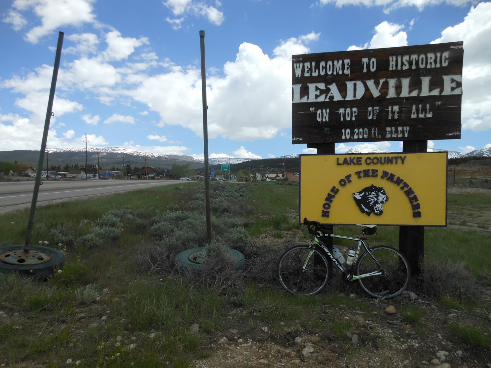
By the time I took this photo, I had reached the outskirts of Leadville.
Just read this sign, and I won't need to tell you about Leadville. Gold discovered in 1860, didn't last long, silver discovered in 1870, created a huge rush. My siblings reminded me I was here in 1964 on our driving vacation ("See the USA, in your Chevrolet") from Los Angeles to New York and Washington, D.C. (round trip all in two weeks!!).
The next many pictures were taken as I rode my bike down the middle of the main street in downtown historic Leadville, camera in hand, snapping this way and that way as I rode.
I will come back to the Silver Dollar Saloon, since that's where I had lunch and a recovery brew a bit later.
Our motel is on the far end of town, and when I got there, the van had not yet arrived. So, I rode back to the Silver Dollar Saloon. How could I pass up the Best Wild West Saloon in America?
The saloon was a museum of fun collectibles and Old West. I loved looking all around in it (see the telephone booth over on the far left?)
And the food and beer were great too.
Tonight we will eat at a steak house. Tomorrow is our "Queen Stage", the term given to a multi-day cycling race's most difficult stage (not that our tour is a race). It's not only the most difficult day of this first segment of the ride to Canada, but the most difficult of the entire tour - 98 miles and 8700 feet of climbing. Three major passes to climb (including Loveland Pass at 12,000 feet!) and descend. And then Friday is a day of rest before Segment 2 begins on Saturday. As a reminder, I will ride only the first five days of Segment 2.
Tomorrow's map and profile: http://ridewithgps.com/routes/7813487
Fun to watch yourself on a sunny morning! The ride to Leadville was almost all gradual uphill - gaining 4000 feet during the 60-mile ride. As you'll see from the pictures below, it was scenic with the 14,000-foot peaks to the west, and the Arkansas River next to us all the way.
I'd do better just to post pictures, which will speak for themselves. I did stop in Buena Vista for the 25-mile rest, but other than that it was just riding and seeing what the photos will demonstrate. One note: Corey had been coughing a lot in the past two days, and when it was getting worse this morning, he went to a clinic in Buena Vista and he was diagnosed with an upper respiratory infection. He now has meds, so I hope he will be fine for tomorrow's grueling day.
As we left Salida, the mountains ahead. Craig flagged down the van to get a jacket because he thought it was cold, whereas I wore nothing extra, not even a t-shirt due to what I considered a warm morning. Craig said I was a freak of nature! hahaha. I admit it was brisk, but just thinking what Janet is enduring back home with the heat and humidity made me appreciate the brisk morning. It was not long at all before it got hot and I was glad I was not wearing anything more.
By the time I took this photo, I had reached the outskirts of Leadville.
Just read this sign, and I won't need to tell you about Leadville. Gold discovered in 1860, didn't last long, silver discovered in 1870, created a huge rush. My siblings reminded me I was here in 1964 on our driving vacation ("See the USA, in your Chevrolet") from Los Angeles to New York and Washington, D.C. (round trip all in two weeks!!).
The next many pictures were taken as I rode my bike down the middle of the main street in downtown historic Leadville, camera in hand, snapping this way and that way as I rode.
I will come back to the Silver Dollar Saloon, since that's where I had lunch and a recovery brew a bit later.
And the food and beer were great too.
Tonight we will eat at a steak house. Tomorrow is our "Queen Stage", the term given to a multi-day cycling race's most difficult stage (not that our tour is a race). It's not only the most difficult day of this first segment of the ride to Canada, but the most difficult of the entire tour - 98 miles and 8700 feet of climbing. Three major passes to climb (including Loveland Pass at 12,000 feet!) and descend. And then Friday is a day of rest before Segment 2 begins on Saturday. As a reminder, I will ride only the first five days of Segment 2.
Tomorrow's map and profile: http://ridewithgps.com/routes/7813487
Subscribe to:
Posts (Atom)