Tuesday, August 4 Day 3 Winthrop to Leavenworth, WA 124 miles, 4000' of climbing
We rode along the mighty Columbia River for much of the day today. Our lunch stop, at Mile 92, was here below the Rocky Reach Dam. I did have a hard time enjoying much of the ride because of a bad saddle sore and the hot, dry winds.
After another big breakfast in the motel parking lot, we rolled down the Methow River valley for about 40 miles. It was relatively flat, and the weather had not yet gotten too hot and windy. This part of the day was very pleasant! The scenery was nice, sort of like Southern California.
I liked how this bend in the Methow River looked.
This was our first view of the Columbia River, where the Methow drained into it. I actually crossed the road to take this photo back at the confluence a half-mile down the hill. Back in 2012 on our ride to Alaska, we saw the Columbia near its origin in British Columbia. Cool to see it here on its flow southward before it turns west. We will cross it in a few more days on our way to Mt Hood.
Another view of the Columbia River. That haze in so many of my photos both yesterday and today is from various wildfires the state is suffering lately. By now in the day, it had gotten into the 90s and the wind was blowing. It always seemed like we had a headwind! The water in your water bottles warms up REAL fast and it's difficult to drink enough of it when it's warm like that. Even when you fill up at the rest stops with two bottles full of ice water, it seems to be warm again within a few miles. Thus, I tend to get dehydrated on a day like this.
This also is the Columbia, as we departed Hwy 97 to take a loop along Apple Acres Road before rejoining the highway.
Sure enough, they grow Washington apples along Apple Acres Road! This valley had dramatic steep cliffs on both sides, so it was a pretty diversion from the Columbia River valley.
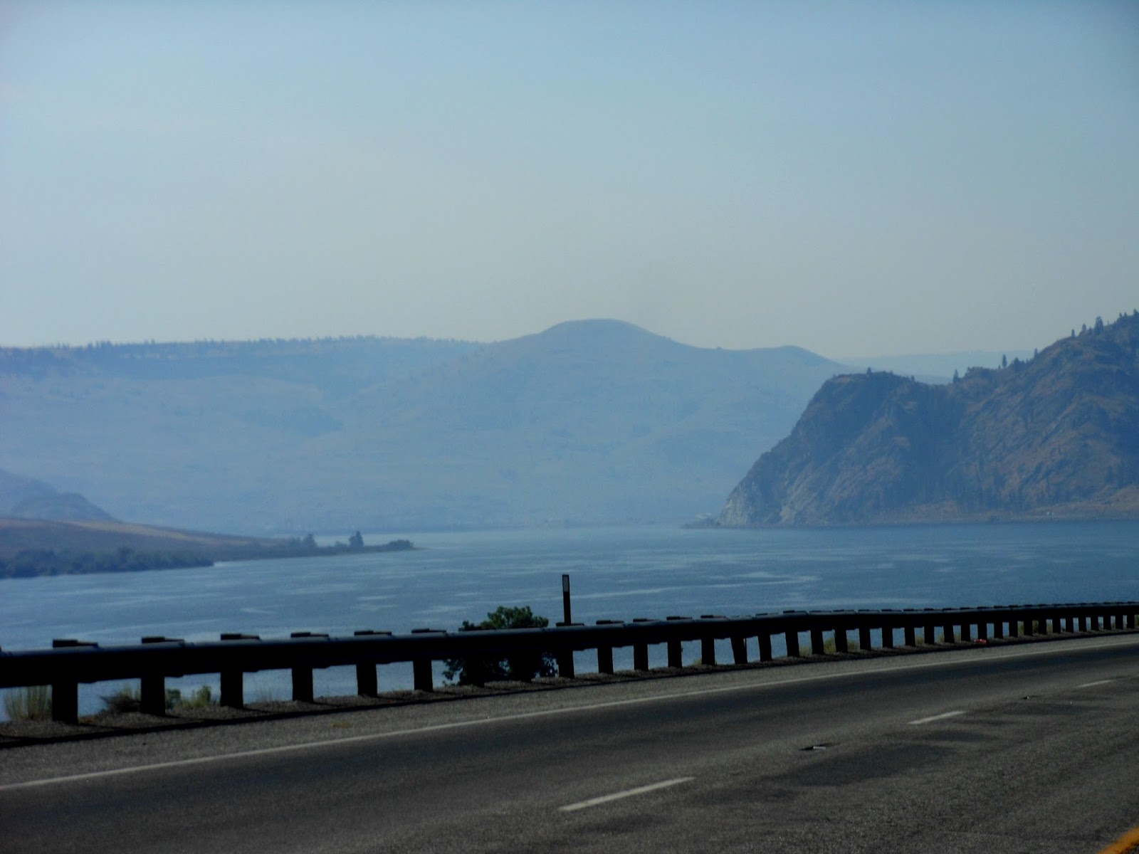
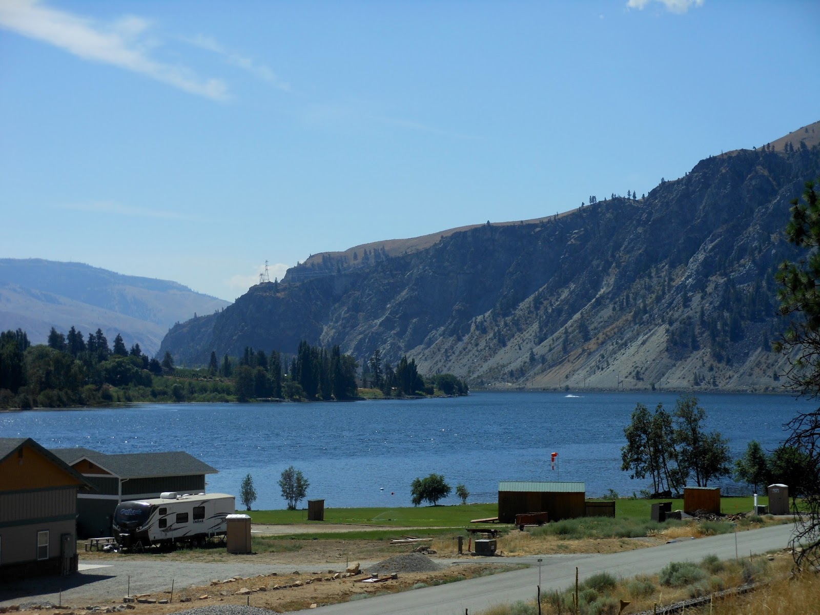
Our route also diverted us to Chelan Lake (whose river beyond the dam empties into the Columbia).
It was a HUGE lake, with lots of boaters and fishermen.
As we were departing the lake to ride south back to the Columbia River, we passed many vineyards. You can again see how hazy the sky was.
Our road rejoined the Columbia, and it was always a pretty sight. I was wishing I were water skiing out there.
Here comes the train!
The sign said there was a Vista Point, so I pulled off and rode up a small hill to see the river again, but through a chain link fence!
Just after this was our lunch stop, and I took no more photos other than the one at the top of this posting. The open sore on my butt was hurting too much, and it was just too hot and windy for me to be in the mood to stop and take pictures. If we had taken the shortest route into Leavenworth, we would have stayed on Hwy 2 all the way from the Columbia River turn off. Instead, we rode on twisty and sometimes hilly side roads to get here. When we made our turn onto Deadman Hill Rd, I knew we were in for a doozy. That hill was super steep (11%) and went on a long ways up up up.
Although I felt tired and was not thinking I was riding all that well, I looked at my odometer when I got to 100 miles and my average speed was still 16.9 mph. For me, that's still pretty fast, so I guess I was doing better than I felt.
Our motel, the Icicle Inn, was a bit beyond the main downtown of Leavenworth. I went ahead and walked back and stopped at the first restaurant in the "Bavarian" section, called Gustav's. Janet and I ate there when we were here four years ago in snowy November. Not a bit of snow to be seen today though. My beer was one made locally at Icicle Brewery (no relation to our motel. The mountain peak nearby is Icicle Mountain, and the original town nearby was Icicle).
I stole this photo from the Internet showing the main Bavarian-themed street in town. Lots of German restaurants in there. You can't see Gustav's beyond the tree on the right.
Tomorrow we will continue south on the eastern side of the Cascades to Selah, which is a little northwest of Yakima. It's a shorter day - 89 miles - "recovery".


No comments:
Post a Comment